ONEONTA SUSQUEHANNA GREENWAY A scenic, traffic-free trail for outdoor recreation for all ages!
Welcome to OSG!
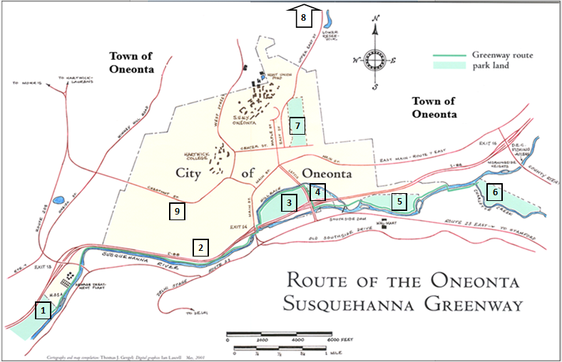
The Oneonta Susquehanna Greenway (OSG) consists of multiple trail segments along the Susquehanna River and tributaries (see map below). It began as an effort to reconnect Oneonta residents with the river after Interstate 88 cut off easy access. The first section opened at Silas Lane in 2006, followed by trails along the Mill Race in Neahwa and Catella Parks, and on New Island.
Early plans to link these areas faced numerous setbacks, so the committee shifted focus to expanding into additional locations in the watershed area, resulting in trails in Wilber Park, in the Wilber Lake Lake area including along the Oneonta Creek, and at Roundhouse Road.
Working with the City of Oneonta, we returned to our original goal and now have plans for that connecting link and hope to have a route from New Island to Silas Lane in the next year.
Locations of
OSG trails
VOLUNTEERS NEEDED!
With miles of trails in use and more in the works, we need help! Contact Us if you are interested in helping with maintenance, trail building, fundraising, and/or planning new trails.
WORKDAYS:Our next scheduled workday will be August 1st, 9:00 AM, at the Roundhouse Road trail. Meet at the trailhead near Noah’s World.
News and Updates: Click to see what’s happening at the OSG trails. The Oneonta Creek Trails have been temporarily reopened, pending one more logging job. Some trail is still needed.
Oneonta Susquehanna Greenway River trails
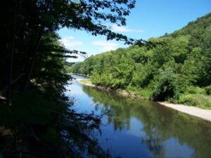
Silas Lane– Open. 2-mile grassy loop trail, half with river views. Level, signage, parking.
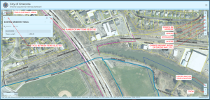
6th Ward route – in planning stage: a link route on streets and sidewalks from Luther St. via the 6th Ward, then westward to River St. Ext. via a City easement paralleling I-88.
Millrace Trail -Open. Paved ADA-compliant trail running along the Mill Race behind Damaschke Field.
Catella Park– Open. Paved. 0.5 mile loop. Connects New Island via marked sidewalk under I-88 Exit 15.
New Island– Open. 3.3 miles of multiple mountain bike trails open to walkers. City dam and fishing area. Wooded floodplain and river views along the old Delaware-Otsego rail bed.
Fortin Park (future link). Working with City, Town, and Future for Oneonta Foundation to create a link between New Island and Fortin Park.
Trails maintained by OSG outside of Susquehanna River route.
Van Cleft Bird Sanctuary– Open. County Forest land. Start by kiosk on the upper level of Wilber Park, connects by orange trail to Van Cleft loop. Deep woods, hilly 1 mile route, connects to H.S. trails.
Oneonta Creek Trails 3.3 miles of trails on City watershed lands.South end at the Y of Upper East St. and Wilber Lake Rd. Crosses Lower Cross Rd (roadside parking). North end terminates at Wilber Lake Dam. Parking area on Wilber Lake Rd. by gate with sign. NOTE: These trails are temporarily open but will close in the future for one more logging operation.
-NOTE: These trails are now open after months of being closed for logging.
Roundhouse Trail – Step into nature on this short but fun 1/3 mile wooded trail. Bridges and boardwalks keep you dry as you travel through woods, wetland, and meadow. Best parking is on Roundhouse Road near Noah’s World. We hope to expand this trail around the industrial park in the future.